
I had written before about useful hiking info on the Internet and what guide books I use, but I’ve never shared all the useful apps that I use when going out hiking in Hong Kong:
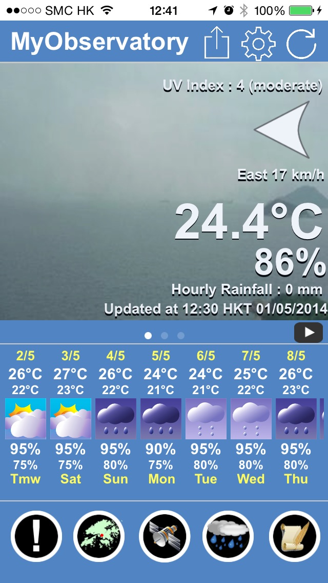
MyObservatory (iTunes / Android)
This is the best app to use BEFORE a hike, when you are trying to find out what the current weather situation in Hong Kong is. Not only does it provide very accurate forecasts, but it has lots of useful features. The location-based rain feature will let you know if rain is going to fall in your current location in the next two hours. If you check this and then also radar and satellite images, you can easily tell if you will stay dry or not. Also, if there is already a thunderstorm in town, use the Lighting Location and Radar & Lightning features to see where the lighting is strong and where it is heading – you don’t want to hike in these areas. Plus the storm track is useful to keep you alert if the T1, T3 or T8 alarms will be raised soon – again, you don’t want to be out hiking if there is a thunderstorm or big storm happening soon. Of course, a little rain is not going to hurt you, you just have to be prepared and where sensible clothes.
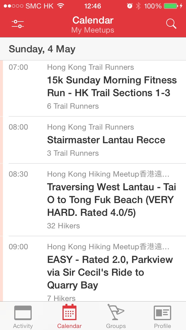
MeetUp (iTunes / Android)
Of course, this is the app I use to see what MeetUp hikes are on – I check out the Hong Kong Hiking MeetUp group to see what is being organised, there are usually about three hikes a day (sometimes even more). The app is also useful as I can add the hike to my calendar and see all relevant information about who is organising and joining the hike, where’s the meeting point, what to bring – and finally, after the hike this is where we share pictures and stay connected.
Enjoy Hiking (iTunes / Android)
The Agriculture, Fisheries and Conservation Department has launched this app to showcase various hiking trails in Hong Kong – and it is very useful! You can select suitable route with reference to your interest, physical fitness and experience to enjoy hiking in the countryside of Hong Kong. Most importantly, you can activate a hiker tracking service when you go hiking (more info in my previous blog post here)

Google Maps (iTunes / Android)
This is always useful – the GPS tracker helps me to see where I currently am and where I need to go… It has helped me a few times. But a word of warning: do not use this as a sole basis for your hike. Google Maps is not comprehensive, some paths are not included and you might get lost. It’s always better to bring a map or guide book along with you (if you don’t hike with a group or friends who know the way) – but every now and then, checking with Google Maps helps to see where you currently are and how far you (roughly) will have to go.

RunKeeper (iTunes / Android)
This is my personal favourite to track all the hikes and runs I’ve done. It’s easy and works well, I just switch it on and the GPS tracks me on a map. At the end of the hike I can see my pace, route distance, elevation and calorie burn for any fitness activity – and then I can use the online version to check out specific details about my hike. If I want, I could even compare myself to others, join fitness groups or see how I improved over time. I’m not interested in that, but I like that the app tracks my progress over time. So the benefit of this app over Google Maps is that I can see where I’ve been already, it keeps a red trail on my map all the time.

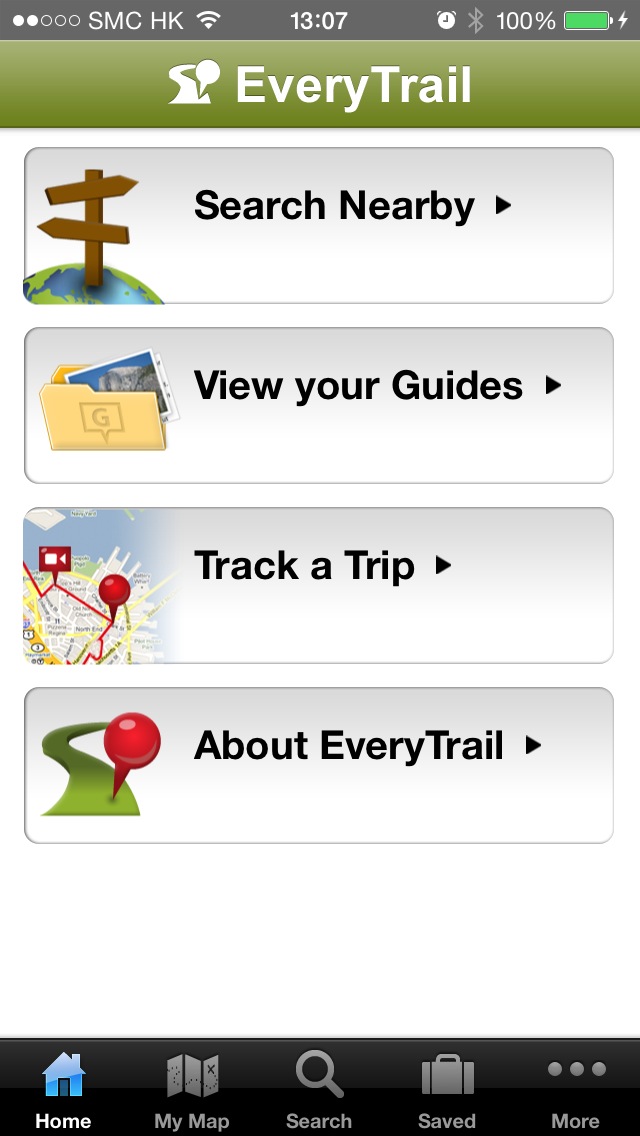
EveryTrail (iTunes / Android)
EveryTrail lets you also track trips and share them with friends – it’s specifically aimed at hikers, so it has a few more options than Runkeeper. Plus when you upload it, you can add photos and videos to the map. A lot of my hiker friends have used it and I just recently started to trial it, so far I really liked it!

Wow, all useful and interesting apps!!